Long
Just over 50 km from northeast to southwest.

SIZE, ICE, GEOLOGY AND CHANGE
Langjökull is Iceland’s second-largest ice cap, stretches just over 50 kilometres and is shrinking fast enough that its quoted area depends strongly on the measurement year.
QUICK ANSWER
Langjökull means “Long Glacier.” It is a broad ice cap in Iceland’s central western highlands and the country’s second-largest after Vatnajökull.
Langjökull runs roughly northeast to southwest. Length: Just over 50 km. Upper-surface elevation: Around 1,400 m. Outlet areas descend toward the surrounding highlands and lakes.
The area is not fixed. A study described about 920 km² around 2009, and a 2021 reference reports about 832 km². The later summary used here gives About 800 km²; its associated image date is not an independently confirmed survey date.
Just over 50 km from northeast to southwest.
Mean thickness around 200 m in a recent summary.
Area and volume have fallen substantially since the 1800s.
Rounded area published by the Glacier Change project. The source summary is paired with August 2023 imagery; that is not an independently confirmed measurement date. Source and context.
INTERACTIVE GUIDE
Select a topic for a concise fact and the most important context.
SIZE
Older sources commonly quote 920 to 950 km². The difference is real retreat plus different measurement dates and methods, not simply a typo.
AT A GLANCE
Rounded figures are used because glacier boundaries and surface elevations change, and sources do not all use the same observation year.
Second-largest ice cap in Iceland, after Vatnajökull.
Just over 50 kilometres from northeast to southwest.
Square kilometres in a recent satellite-based glacier summary.
Metres above sea level, rounded from published figures near 1,430 to 1,450 m.
Metres of mean thickness in a recent research summary.
Metres reported as the historical maximum thickness in older references.
Cubic kilometres in a recent glacier-change summary.
Iceland’s emergency number when visiting the highlands or glacier.
SOURCE YEAR MATTERS
The glacier is shrinking, and each figure describes a particular measurement date and method.
Estimated Little Ice Age area in a recent glacier-change summary.
Area used in the Langjökull mass and volume study covering records to 2009.
Area reported by Perlan using a 2021 reference.
Rounded figure paired with an August 2023 satellite image by Glacier Change.
A travel page quoting 950 km² may be repeating a valid older figure. For current content, label the observation year or use a rounded range with an explanation.
FORM
Langjökull is an ice cap rather than one narrow valley glacier.
The ice spreads across broad highland terrain and divides into multiple named catchments and outlet areas.
The main body runs northeast to southwest, broadly aligned with Iceland’s active volcanic zone.
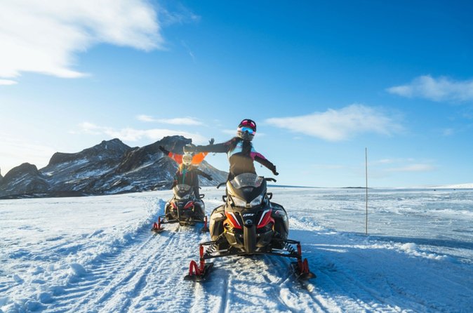
Large open upper surfaces are one reason guided snowmobiling is strongly associated with Langjökull.
UNDER THE ICE
Langjökull covers part of an Icelandic rift-zone volcanic system.
The Oddnýjarhnjúkur-Langjökull system includes fissure vents, shield volcanoes, a caldera and subglacial volcanic landforms.
The Hveravellir central volcano lies near the northern part of the system. The surrounding Kjölur landscape includes tuyas and shield volcanoes formed through different volcanic settings.
The Smithsonian Global Volcanism Program identifies the extensive Hallmundarhraun lava flow with an eruption around 950 CE.
The Geysir thermal area lies near the southern end of the fissure system, helping explain the close geographic link between the Golden Circle and Langjökull.
The geological system explains the landscape and geothermal features. Current hazard information should come from the Icelandic Meteorological Office and SafeTravel.
Smithsonian volcano profileMELTWATER
Langjökull stores freshwater and feeds rivers, lakes and groundwater systems around western and southern Iceland.
Snow accumulates and becomes glacier ice.
The lake lies near the eastern foot of the glacier.
The river flows from the lake toward the settled lowlands.
Hvítá drops through the famous two-stage waterfall.
Visible lakes and rivers are only part of the system. Meltwater also moves below and through the surrounding volcanic ground.
Modelling projects runoff to rise for a period as melting increases, then fall as the ice-covered area becomes much smaller.
ICE CATCHMENTS
Langjökull is divided into multiple named glacier catchments and outlet areas rather than one single front.
Eastern outlet areas associated with the Hvítárvatn side of the glacier.
Eastern and western Hagafellsjökull outlet areas occur around the southern end.
A prominent outlet and ice-covered highland area toward Geitland and Húsafell.
Other named areas include Baldjökull, Þrístapajökull, Flosajökull and several northern catchments.
Names and boundaries can differ between map sources and scientific usage. This list is illustrative, not a complete official inventory.
RETREAT
Langjökull has lost substantial area, thickness and volume since the Little Ice Age.
Rounded comparison from the nineteenth-century maximum estimate to a recent summary.
Rounded decline described by the Glacier Change project.
Average current thinning stated in the same project summary.
MODELLED FUTURE
Published modelling shows that Langjökull is highly sensitive to warming and could lose most or nearly all of its ice during this century under warmer climate scenarios. The exact outcome depends on future climate, snowfall and model assumptions.
Projected range, not a guaranteed date
VISITING
The glacier’s scale is easiest to understand from a guided route across the upper ice.
Current visitor experiences include snowmobiling, specialist glacier vehicles and the engineered Into the Glacier tunnel. The route and surface look different by season and weather.
Guided rides use routes chosen for the day’s conditions.
The Into the Glacier tunnel was engineered for guided access inside the ice.
Current tours connect from Reykjavík, Gullfoss, the Geysir area and Húsafell.
FAQ
Direct answers to the most common Langjökull fact questions.
It means Long Glacier in Icelandic, a reference to its elongated shape.
No. It is Iceland’s second-largest ice cap after Vatnajökull.
The summary used here gives About 800 km². Older references describe larger areas. Compare measurement dates and methods rather than treating all figures as simultaneous measurements.
The ice cap extends just over 50 kilometres from northeast to southwest.
Published maximum elevations cluster around 1,430 to 1,450 metres above sea level.
A recent summary gives a mean thickness of about 200 metres. Older sources report a maximum thickness of about 580 metres in places.
Langjökull covers part of the Oddnýjarhnjúkur-Langjökull volcanic system, which contains subglacial and fissure-volcanic features.
Yes. Research documents major loss of area and volume since the nineteenth century.
Yes, through guided snowmobiling, specialist vehicle and ice-tunnel experiences. Independent glacier travel requires expertise and equipment.
RESEARCH AND DATA
The figures are labelled by date because the glacier is changing.
Facts reviewed: August 28, 2026